
Carter Associates, Inc. 772-562-4191 📩inquiries@carterassoc.com
Carter Associates, Inc. 772-562-4191 📩inquiries@carterassoc.com
1708 21st Street, Vero Beach, Florida 32960
1708 21st Street, Vero Beach, Florida 32960
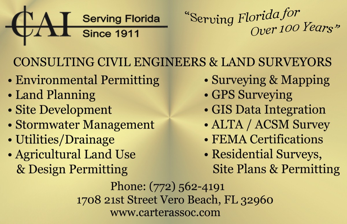
CARTER ASSOCIATES, INC. “THE RIGHT CHOICE” SERVING FLORIDA FOR OVER 100 YEARS, PROVEN QUALITY & EXPERTISE.
CARTER ASSOCIATES, INC. “THE RIGHT CHOICE” SERVING FLORIDA FOR OVER 100 YEARS, PROVEN QUALITY & EXPERTISE.
Professional Land Surveying and Mapping Services
Carter Associates, Inc. located at 1708 21st Street Vero Beach, FL 32960 provides Professional Land Surveying and Mapping Services to residential, commercial, agricultural, municipal,governmental, land planning, utility, and transportation institutions and agencies. The highly experienced land surveyors and mappers of CAI produce quality Land Surveying and Mapping project deliverables to a multitude of areas including sensitive wetland areas. Below is a breakdown of some of our many Land Surveying and Mapping Services services.Residential Services
- Mortgage Surveys
- Boundary Surveys
- Topographic Surveys
- Residential & Manufactured Home Site Plans
- Permitting
- Geodetic / GPS Static, Rapid Static, Kinematic
- Real Time Kinematic Surveys
- GIS Data Acquisition & Mapping
- As-Built & Record Surveys
- Mean High Water Surveys
- Riparian Rights Surveys
- HUD Surveys
- Environmental, Conservation, Wetland, Seagrass
- Mitigation Surveys
- FDEP Permit Surveys
- FDEP Coastal Construction Control Line Surveys
- Marine, Dock & Pier Surveys
- Affidavit of Exemptions & Parcel Splits
- Record Platting
- Condominium Exhibits & Documents
- Construction Layout Surveys
- Horizontal & Vertical Control Surveys
- Aerial Photogrammetry & Mapping Services
Commercial Services
* Boundary Surveys
* Topographic Surveys
Read More
* Residential & Manufactured Home Site Plans
* Permitting
* Geodetic / GPS Static, Rapid Static, Kinematic
* Real Time Kinematic Surveys
* GIS Data Acquisition & Mapping
* As-Built & Record Surveys
* Mean High Water Surveys
* Riparian Rights Surveys
* HUD Surveys
* Environmental, Conservation, Wetland, Seagrass
* Mitigation Surveys
* FDEP Permit Surveys
* FDEP Coastal Construction Control Line Surveys
* Marine, Dock & Pier Surveys
* Affidavit of Exemptions & Parcel Splits
* Record Platting
* Condominium Exhibits & Documents
* Construction Layout Surveys
* Horizontal & Vertical Control Surveys
* Aerial Photogrammetry & Mapping Services
Residential Surveying Services
◆ Mortgage Surveys
◆ Boundary Surveys
◆ Topographic Surveys
Read More
- Residential & Manufactured Home Site Plans
- Permitting
- Geodetic / GPS Static, Rapid Static, Kinematic
- Real Time Kinematic Surveys
- GIS Data Acquisition & Mapping
- As-Built & Record Surveys
- Mean High Water Surveys
- Riparian Rights Surveys
- HUD Surveys
- Environmental, Conservation, Wetland, Seagrass
- Mitigation Surveys
- FDEP Permit Surveys
- FDEP Coastal Construction Control Line Surveys
- Marine, Dock & Pier Surveys
- Affidavit of Exemptions & Parcel Splits
- Record Platting
- Condominium Exhibits & Documents
- Construction Layout Surveys
- Horizontal & Vertical Control Surveys
- Aerial Photogrammetry & Mapping Services
Commercial Surveying Services
◆ ALTA/ACSM Land Title Surveys
◆ Site Plans & Permitting
◆ Topographic Surveys
Read More
- Boundary Surveys
- Topographic Surveys
- Geodetic / GPS Static, Rapid Static, Kinematic
- Real Time Kinematic Surveys
- GIS Data Acquisition & Mapping
- Mean High Water Surveys
- Riparian Rights Surveys
- Environmental, Conservation, Wetland,
- Seagrass & Mitigation Surveys
- FDEP Permit Surveys
- FDEP Coastal Construction Control Line Surveys
- FDEP Marine, Dock & Pier Surveys
- Hydrographic / Bathymetric Surveys
- Record Platting
- Condominium Exhibits & Documents
- Communications ( Cellular Tower ) Surveys
- Horizontal & Vertical Control Surveys
- Construction Layout Surveys
- Route & Utility Location Surveys
- Sketch and Descriptions
- Property Ingress / Egress Utilities,
- Conservation Surveys
- Environmental Areas,
- Stormwater Tracts Surveys
- Easement Surveys
- Construction Staking
- Settlement Monitoring
- Title Resolution Surveys
- As-Built & Record Surveys
- Lot Line Adjustments Surveys
- Property Subdivisions Surveys
- Aerial Photogrammetry & Mapping Services
Residential Services
* Mortgage Surveys
* Boundary Surveys
* Topographic Surveys
Read More
* ALTA/ACSM Land Title Surveys
* Residential & Manufactured Home Site Plans
* Permitting
* Geodetic / GPS Static, Rapid Static, Kinematic
* Real Time Kinematic Surveys
* GIS Data Acquisition & Mapping
* As-Built & Record Surveys
* Mean High Water Surveys
* Riparian Rights Surveys
* HUD Surveys
* Environmental, Conservation, Wetland, Seagrass
* Mitigation Surveys
* FDEP Permit Surveys
* FDEP Coastal Construction Control Line Surveys
* Marine, Dock & Pier Surveys
* Affidavit of Exemptions & Parcel Splits
* Record Platting
* Condominium Exhibits & Documents
* Construction Layout Surveys
* Horizontal & Vertical Control Surveys
* Aerial Photogrammetry & Mapping Services
Residential Services
* Boundary Surveys
* Topographic Surveys
Read More
* Residential & Manufactured Home Site Plans
* Permitting
* Geodetic / GPS Static, Rapid Static, Kinematic
* Real Time Kinematic Surveys
* GIS Data Acquisition & Mapping
* As-Built & Record Surveys
* Mean High Water Surveys
* Riparian Rights Surveys
* HUD Surveys
* Environmental, Conservation, Wetland, Seagrass
* Mitigation Surveys
* FDEP Permit Surveys
* FDEP Coastal Construction Control Line Surveys
* Marine, Dock & Pier Surveys
* Affidavit of Exemptions & Parcel Splits
* Record Platting
* Condominium Exhibits & Documents
* Construction Layout Surveys
* Horizontal & Vertical Control Surveys
* Aerial Photogrammetry & Mapping Services
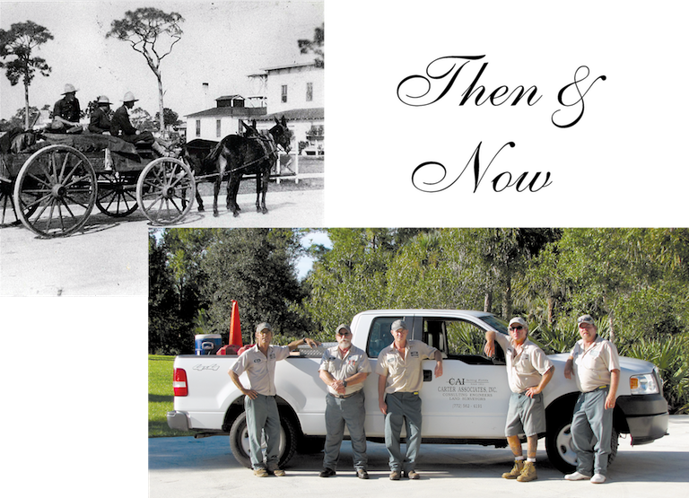
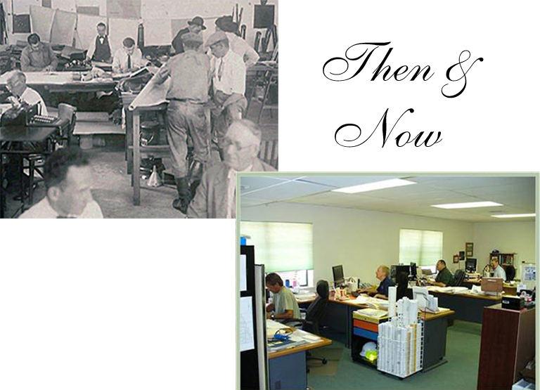
Then: One of the Carter’s survey crews circa 1915.
Now: A very different mode of transportation but still with four wheels!
Historical Perspective
Carter Associates, Inc. is one of Florida's oldest and most respected consulting engineering and land surveying firms, tracing its roots back to 1911.
No other engineering and surveying firm has the advantage of over a CENTURIES WORTH OF EXPERIENCE AND KNOWLEDGE of the Treasure Coast and the State of Florida.
Community Impact
The heritage of pioneering families such as the Carter's is strong. Over the years, CAI has worked on many major projects-both public and private. In the City of Vero Beach's formative years, CAI had a great impact on the community's development by providing surveying and layout of the City of Vero Beach starting in 1914; layout of State Road 60 in the 1920's; design and construction of one of the community's first housing subdivisions, the unique McAnsh Park; and assisting in the construction of many of the Treasure Coast's original barrier island bridges. But the impact oh the development of this community does not lie only in the past.
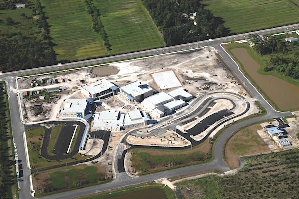
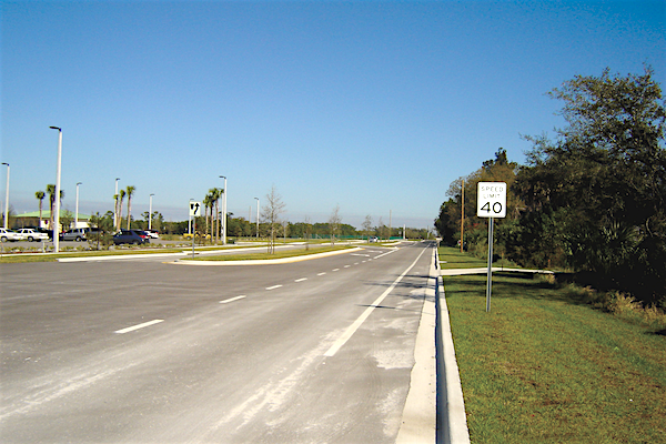
CAI continues to be actively engaged in projects affecting the community today-- including roadway projects: portions of 26th Street, 43rd Avenue, 66th Avenue, 57th Street, 81st Street and State Road AlA-- including public park projects: North County Regional Park,Wabasso Causeway Park, Round Island Oceanfront Park--including governmental projects: County Parks Maintenance Facility, County Utility Operations Complex, Indian River Farms Water Control DiStrict Operations Complex, School District of Indian River County Support Services Complex-and school projects: Treasure Coast Elementary, Liberty Magnet, Vero Beach High School Renovation and Storm Grove Middle School-the School District's first "green" school.

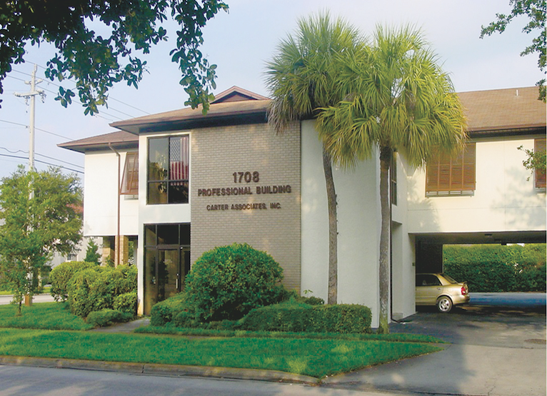
Then: Hard at work inside R.D. Carter's office at 21st Street and 14th Avenue.
Now: Today's office is located just blocks away from the original location.
Then: Hard at work inside R.D. Carter's office at 21st Street and 14th Avenue.
Now: Today's office is located just blocks away from the original location.
Community Impact
The heritage of pioneering families such as the Carter's is strong. Over the years, CAI has worked on many major projects-both public and private. In the City of Vero Beach's formative years, CAI had a great impact on the community's development by providing surveying and layout of the City of Vero Beach starting in 1914; layout of State Road 60 in the 1920's; design and construction of one of the community's first housing subdivisions, the unique McAnsh Park; and assisting in the construction of many of the Treasure Coast's original barrier island bridges. But the impact oh the development of this community does not lie only in the past.
CAI continues to be actively engaged in projects affecting the community today-- including roadway projects: portions of 26th Street, 43rd Avenue, 66th Avenue, 57th Street, 81st Street and State Road AlA-- including public park projects: North County Regional Park,Wabasso Causeway Park, Round Island Oceanfront Park--including governmental projects: County Parks Maintenance Facility, County Utility Operations Complex, Indian River Farms Water Control DiStrict Operations Complex, School District of Indian River County Support Services Complex-and school projects: Treasure Coast Elementary, Liberty Magnet, Vero Beach High School Renovation and Storm Grove Middle School-the School District's first "green" school.
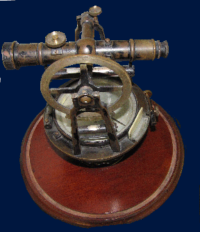
Technology And Professional Expertise
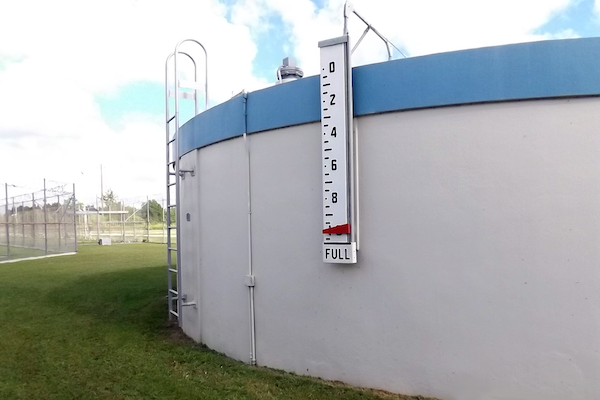
At Carter Associates, Inc., we invest in the latest technology utilizing the best available equipment, hardware and software to service our clients and keep up with the changing times. CAI provides continual training for our employees to ensure our clients are provided with state-of-the-art top quality deliverables. Our staff utilizes modem computer aided drafting software to produce drawings that are easy to interpret. We utilize the latest software for computer modeling of systems including watersheds,hydraulic systems and groundwater. Our surveyors are equipped with the latest electronic surveying equipment along with access to trucks, boats, all-terrain vehicles and any piece of gear needed to perform at the highest level under any circumstance, producing quality work safely. At CAI, our most valuable resource is our people. We are equipped with a large staff of Professional Engineers and Professional Land Surveyors & Mappers, along with field survey crews, technicians,draftsmen and administrative support personnel. Our technology and professional expertise allows us at CAI to offer a complete and integrated menu of professional services to our residential, commercial, agricultural and governmental clients.
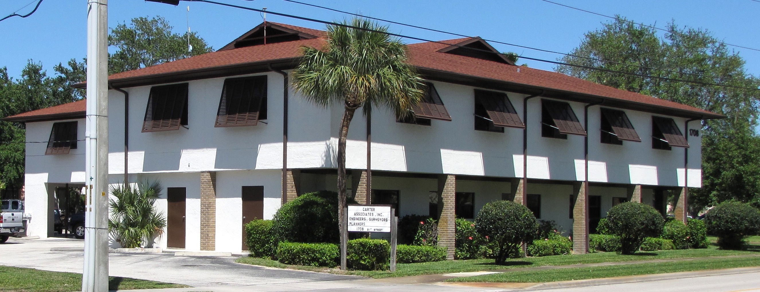
The offices of Carter Associates, Inc.are located in Historic Downtown
Vero Beach at 1708 21st Street.
“CAI” “THE RIGHT CHOICE” for all your Civil Engineering, Surveying and Mapping needs.
CAI's staff of Civil Engineers, Surveyors and Mappers effectively delivers multi-disciplinary services to local, state and federal government agencies, as well as the residential, commercial, municipal and agricultural sectors.
Telephone and Fax
PHONE: (772) 562-4191
FAX: (772) 562-7180
📩inquiries@carterassoc.com
Office Location
The Professional Civil Engineering and Land Surveying offices of Carter Associates, Inc. are located at 1708 21st Street, Vero Beach, Florida 32960.